
Snowman Trek
Trip Snapshot
- Duration: 31 Days / 30 Nights
- Region: Western and Central Bhutan
- Difficulty: Extreme (Experienced trekkers only)
- Best season: Spring (March–May) and autumn (September–November)
The Ultimate Challenge:
This is it—the crown jewel of Himalayan trekking. The Snowman Trek is our longest and most challenging tour, designed for those who want to push beyond the ordinary. It will take you to the most breathtaking places in the Kingdom of Bhutan and the greater Himalayas.
The Route:
Over 31 days, you will travel from Paro and begin trekking from Sharna Zampa to Laya, venturing deep into the remote Lunana region and onward to Gangkhar Puensum and Bumthang. You will cross high passes and traverse some of the most isolated villages on Earth.
The Highlights:
Follow the old trails of the yak herders and enjoy spectacular views of Mount Jhomolhari and the great Himalayan peaks of Bumthang. We have built in one or two rest days at the famous Dhur Hot Springs to rejuvenate halfway through the trek. Beyond the trail, you will also explore the cultural heart of Bhutan—visiting Bumthang, Gangtey, Punakha, and the capital, Thimphu.
The Conditions:
The best time for the Snowman Trek is the first three weeks of October, when the weather is perfect—free of wind and snow. You will camp at altitudes over 5,000 meters, and depending on the season, your camps may be pitched directly on snow. Due to its high difficulty, this trek is strictly for experienced trekkers.
Day-by-Day Itinerary
DAY 01 Arrive Paro
The flight to Paro crosses the Himalayan Mountains, affording spectacular views of the awesome peaks, including the sacred Jumolhari and Jichu Drake peaks in Bhutan. On arrival, you will be greeted by the guide and transferred to the hotel. In the afternoon, visit the Ta Dzong, once a fortified lookout tower that is now the National Museum. The museum has wide assortment of ancient paintings, philatelic display and “field of Buddhas”, which helps one to visualize while meditating.
DAY 02 Acclimatization hike to Tiger's Nest Monastery
After breakfast hike to Taktsang (Tiger’s Nest) Monastery, Bhutan’s most famous monastery, which stands at 3100m. The hike helps acclimatize for the next day’s trek. The 8th century Spiritual Master, Guru Rinpoche, is said to have flown on the back of a tigress to meditate in a cave where Taktsang Monastery now stands. It is perched on the edge of a steep cliff, about 900 meters above Paro Valley. Lunch will be served in the Cafeteria Restaurant, located about halfway up on the mountain. Explore the Monastery and hike back to Paro. Overnight in Khangkhu Resort, Paro.
DAY 03 Paro to Shingkarap (trek starts)
Today you will drive to Zangkipang, the start points, passing an area of apple orchards and forests. It is a light trek moving slowly on a gradual slope through conifers and rhododendrons flanking the Paro Chhu. In about 2/3 hours of continuous hiking and crossing several streams, you will reach at Shingkharap. It is a wide-open area with a single house which is a stop for rest and meal for highlanders when traveling. You will walk a little further to your campsite. Camp at an altitude of 3110m.
DAY 04 Shingkarap to Soi Thangkha
The trail again follows Pa Chhu (Paro River), ascending and descending through pine, oak, and spruce forests. Hot lunch will be served after crossing the bridge towards the left side of the river. After lunch, follow the river climbing through rhododendron forests and finally crossing the bridge again, you will reach the campsite at an altitude of 3750m.
DAY 05 Soi Thangkha to Jangothang
Although today’s is not a long trekking day, a significant height gain will take place as your trail goes above tree line. From the camp, your path ascends for a while till you reach the army camp. Then follow the river above the tree line enjoying the stunning view of surrounding peaks. We walk through a very muddy section of trail, pass a mani wall and enter yak country. Hot lunch will be served inside a yak herder’s camp.
DAY 06 Acclimatization day and exploration of Jangothang
Today, you will spend a day by doing four-hour acclimatization hike to the north of your camp. There is practically no trail but you will climb on a open and endless slope till you see the view of Mt Jichu Drakye (6989m). You can scramble further up till 4895m (higher than Mount Blanc) to see amazing view of Mount Jumolhari. You are likely to spot rare blue sheep, Himalayan rhubarb, griffon vultures, golden eagles and the remarkable blue poppy. Jangothang base is a flat grassy land with an old ruined fortress on a hillock in the foreground, beneath the colossal Mount Jumolhari and its neighbour Jitchu Drake. Most people show signs of mountain sickness at this altitude and it is recommended that all trekkers halt here.
DAY 07 Jangothang to Lingshi
The trail follows the stream for half an hour and crosses the bridge to the right side. Start the climb up to the first ridge with a breathtaking view of Jumolhari (7314m), Jichu Drake (6989m) and Tsherim Gang (6789m). Then walk towards the valley, almost flat for a while, until you climb to the Ngye La pass at an altitude of 4700m. After the pass, it is a gradual descent to the camp, enjoying the panoramic view of the surrounding peaks and Lingshi Dzong. Camp at an altitude of 4010m.
DAY 08 Lingshi to Chebisa
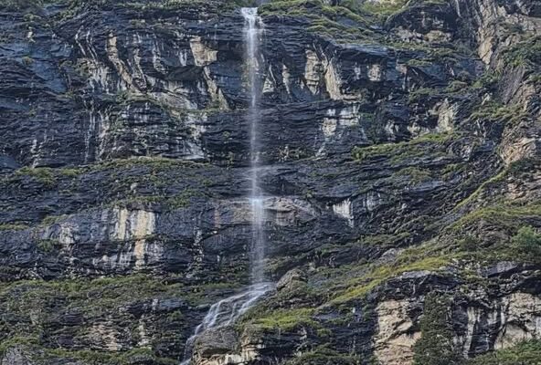
Visit the Lingshi Dzong, perched on the hilltop with a commanding view of green hills, the winding river and magnificent peaks. For centuries, Lingzhi Dzong was a way station for weary Buddhist pilgrims and defense fort against Tibetan and Mongol invaders. It is an easy day and pleasant walk-through villages and yak herder’s camp. After lunch, a short walk will take you to Chebisa, a charming little village adorned with a beautiful crystal-clear waterfall. Camp by the side of stream at an altitude of 3850m.
DAY 09 Chebisa to Shoumuthang
Begin your trek with a stiff climb up a ridge to Gogu La pass (4500m) taking nearly four hours. The sights of rare blue sheep is common on the rocks near the top of this pass. After the pass, descend through rhododendron bushes to a lunch stop. Afternoons continue along the trail with intermittent ascents and descents and after crossing the stream, through rhododendron forests and yak herders camp we arrive at Shakepasa at 3980m. From there, we walked down through a thick rhododendron forest until our next camp in Shakshepasa at 3980m. Climbing steeply up to the northern side of the valley and passing by a couple of yak herder’s camp, we arrive at our camp, which is beside a stream at an altitude 4250m.
DAY 10 Shoumuthang to Robluthnag
The trek starts by walking through edelweiss bound trail with a climb to Jari La pass at altitude 4700m. The snowcapped peak visible to the south-east is Kangbum at 6526m. Then descend to Tsarijathang valley, the summer residence of rare Himalayan Takins (national animal of Bhutan). From here we may have to cross the stream as most of the time the footbridge is washed away. After crossing the stream towards the left, the trail ascends till you reach Robluthang, a rocky meadow camp at an altitude of 4200m.
DAY 11 Robluthang to Lingmithang
Today, you will cross the highest pass in our entire trek. Climb all way up through boggy patches crossing stream, traversing marmot holes and moraine, you will reach at the top of Shingchen La pass (5005m). The view of snow-covered Gangchenta or the Tiger Mountain (6840m) filling the northern horizon is simply stunning. After the pass, descend through rough, rocky trail following moraine river valley to Kango Chhu River. The path is quite narrow, and you may have to cross a stream again and get wet. After walking through cedar forests, we arrive Lingmethang (4140m), which is a beautiful, scattered meadow by the river with Tiger Mountain towering behind your campsite.
DAY 12 Lingmithang to Laya
In the morning you wake up with a superb view of Gangchenta peak in front of you. The walk to Laya is very pleasant with wonderful views. You will pass through a damp forest, filled with moss and singing birds. Arrive at Laya village, the second highest settlement in the country, at altitude of 3,800m.
DAY 13 Rest day at Laya
Explore around Laya village. You can go and visit any of the houses around. Even to a perfect stranger, traditional Bhutanese hospitality is extended, and a cup of tea and Chang (local wine) is always offered. The people in this valley are very interesting especially the women. They wear traditional black wool kiras and conical bamboo hats decorated with turquoise, silver ornaments and strings of beads.
DAY 14 Laya to Rodophu
The trek leads down to the Lunana trail junction and then climbs to hilltop with good views over the Mo Chhu and the Rhodo Chhu. The trail follows Rhodo Chhu valley, first through mixed conifers and then through rhododendron, above the tree line. From top of large rockslide, there is a view of the glacial valley and a massive glacier on Tsenda Gang (7100m). Our camp is at Rodophu at 4160m just beyond a wooden bridge across the Rhodo Chhu river.
DAY 15 Rodophu to Narithang
The trail today also follows the alpine grassland where yaks bound in plenty. The path follows the river through rhododendron shrubs before turning right up the hill. You will then climb to a high open valley through meadows to Tshomo La Pass (4915m). The views of the Mount Jomolhari and Tibetan borders are absolutely breathtaking. Next, you will be hiking on the barren plateau intersecting several yak trails and after some time you will be arriving at Narithang (4900m), which is your camp for tonight.
DAY 16 Narithang to Tarina
Today you will be climbing Ganglakarchung Pass at an altitude of 5120m. From the pass, the views of Kangbum (6530m), Tsendhen Gang (7100m), Teri Gang (7300m) and Jejegangphu Gang (7120m) are superb. You will descend through massive moraines to the edge of straight cliff with views of glacial hanging from Teri Gang that forms two turquoise-colored lakes at the base. The lake towards the left in 1961 due to outburst has caused a flood downstream in Punakha destroying the Mochu Bridge. Descend through a steep path to the U-shaped valley following the Tangchu stream towards right to arrive at your camp at 4350m.
DAY 17 Tarina to Woche
Your trail passes through the junipers down the Tangchu River on the left passing through amazing waterfalls. After a gentle climb out of the valley for some time, you will be making a steep ascent to Woche Village, the first settlement in Lunana region at an altitude of 4350m. The Woche village marks the beginning of the Lunana region and above the village, you will see tomorrow’s route to Ledhi.
DAY 18 Woche to Lhedi
Start climbing up the Woche valley and cross a small stream to go over a moraine. You will then descend to a wooden bridge across a Woche Chu River and climb up past a clear glacial lake to reach Keche La pass (4650m) with magnificent views of nearby mountains including three-prong peaks of Jejegangphu Gang Mountain. The trail then descends to Pochu Valley and reaches Thaga village at 4050m. In the late afternoons, one can expect bitterly cold winds at Thaga Vilalge in autumn. From the Thaga village, we descend passing few scattered settlements, waterfalls and reach Lhedi (4200m) after walking along the Phochu Riverbed. Lhedi village consists of a school, Basic Health Unit and a wireless station.
DAY 19 Lhedi to Thanza
The trek is slightly easy today. We will follow the north bank of Phochu River passing through several small farms and then reach Chuzo Village (4090m) sometime around the lunchtime. Enroute visit the Chezo Dzong. We follow the trail along the riverbed and then climb a steep hill overlooking Thanza valley at 4250m.
DAY 20 Rest day at Thanza
You have two optional activities for today. You can either visit the Thanza village or explore nearby glacial lakes. Thanza Village is virtually untouched, medieval-like society. Most people wear clothes they make by hand, weaving and dyeing their own material. They fashion their own unique hats, boots and and jewelry. Their homes are built from stone walls, hand-hewn wood shingles and clay mortar. They survive on grains battered with yak meat and cheese from the lower valleys. Optionally, you can hike through small moraine rocks to clusters of Raphstreng Tsho and Thorthormi Tsho. These lakes are the source of Phochu River of Punakha, which caused a flood in 1994 due to moraine outburst. The view of 7100m Table Mountain (locally known as Zongphu Gang) is superb as it forms 3000m high wall of ice and snow behind Thanza Village.
DAY 21 Thanza to Tshochena
You will climb to a large boulders hill towards south of Thanza and after few hours of easy walk, we reach Danji (4500m), which is a summer grazing ground for the yaks. At Danji, you may also see herds of blue sheep grazing on the meadows. From Danji, we climb few hundred meters up to the top of the ridge, which offers excellent views of surrounding mountains. Walking for another 20 minutes, will reach at the junction of trails leading to Gangkar Phunsum and Tshochena. We take the trail to the right that leads to Jaze La pass. The Jazela pass, which is at 5200m, offers majestic views of surrounding mountains in all directions. From the pass, the trail descends through snow-capped peaks and lakes to Tshochena 5000m
DAY 22 Tshochena to Jichu Dramo
We follow the shore of a blue-green lake and then climb to a ridge at 5150m, which offers panoramic views of snowy peaks in 360-degree. From here, the road and the microwave tower at Dochu La can also be viewed in far distance. The trail goes up and down over a small, rounded hill. We then pass a glacial lake and reach Loju La pass (5170m), which is a yak pasture with many crisscrossing yak trails. We take a trail that crosses a small saddle-like hill at 5120m to a wide glacial valley. We descend further down to Jichudramo camp (5050m) – this is the highest campsite on our entire trek.
DAY 23 Jichu Dramo to Chukarpo
We will climb through a moraine path to the picturesque Rinchen Zoe pass (5350m), which divides Phochu and Mangdechu basins. The Gangkar Puensum (7520m), the highest mountain in Bhutan can be seen from this pass. Further, the demarcation between the forests and the barren high-altitude areas are remarkably seen from here. Descending through a broad marshy valley with strings of lakes, steep face of moraine and yak pastures, we reach Tampe Chu, which is amidst rhododendron and Juniper forests. We camp at Thongsa Thang (4400m) some distance away from Chukarpo.
DAY 24 Chukarpo to Tampetsho
We descend following the right bank of a river to a Galapang yak pasture at 4025m. We will then climb steeply through forests of junipers and silver firs until we reach Tampetsho. The trail to Tampetsho follows a stream to a beautiful clear, turquoise-colored lake, which is set like in a bowl surrounded by steep ridges. We will camp at end of the lake at 4320m.
DAY 25 Tampetsho to Maraothang
Today, we will climb steeply to the Tampela Pass (4600m). The sight of blue sheep on the mountain slopes above trail is common here. We then descend to the Omtsho Lake. The legend has it that, in 15the century, the famous saint Terton Pema Lingpa miraculously discovered a treasure from this lake. The trail goes toward the shore of the lake and reaches its outlet marked by the prayer flags and then descends steeply pass a waterfall to a small lake. The trail finally meets the left bank of Nika Chu River. After some time, we reach to a large open area close to the confluence a major tributary flowing from east. We will then cross a wooden bridge and walk along mixed forests to reach Maraothang (3620m), which is a wide-open area with yak herder’s camp and your last night camp.
DAY 26 Maraothang to Nika Chhu Zam
The last day of the trek goes gradually downhill through mixed deciduous and bamboo forests. We further descend through forests and pastures connecting to large grassy area overlooking the motor road and Sephu Village (2650m). Your car will be waiting here to transfer you to Wangdue. Overnight hotel in Punakha.
DAY 27 Punakha to Thimphu
Today you will drive to Thimphu, the capital of Bhutan. En route visit Punakha Dzong, which is stunningly situated in between the male and female rivers like an anchored ship. Then drive to Thimphu via Dochula pass. Check into hotel on arrival. After settling in, drive to Kuenselphodrang where the 169ft giant Buddha statue sits. It is supposedly the largest bronze statue in the world. You can spend some time exploring and clicking pictures. Evening is at your leisure. You may explore Thimphu town on your own. Overnight hotel Thimphu.
DAY 28 Thimphu to Paro (depart)
Trek Details
Have Any Question?
Talk to our team — we reply within 24 hours, every day.
-
Phone +975 17 172 094
-
WhatsApp +975 77168484
-
Email btcordinator@gmail.com